Monthly Archives: January 2015

San Diego Historical Landmarks—#12: San Pasqual Battlefield Site

San Diego Historical Landmarks

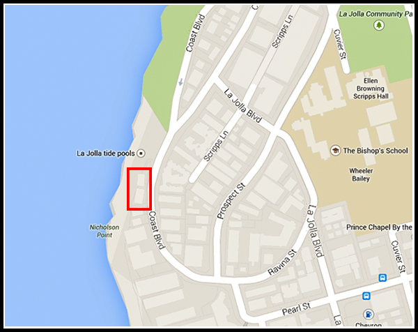
When I first became interested in history at the age of 11, it was all about wars—Civil War, World War I, World War II, and the Vietnam War, which had taken my youngest uncle away from our home. I found the Civil War, the 20-year period leading up to it, and the 20 years afterwards, by far the most interesting.

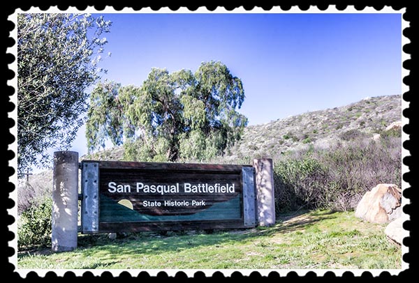
My interest in the period from about 1840 to 1885 has never wavered. Thus, San Diego’s Historical Landmark #12, the San Pasqual Battlefield Site, and the San Pasqual Battlefield State Historic Park, really piqued my interest.

San Pasqual Battlefield State Historic Park

Pictures copyright 2012 Russel Ray Photos

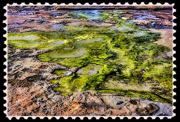
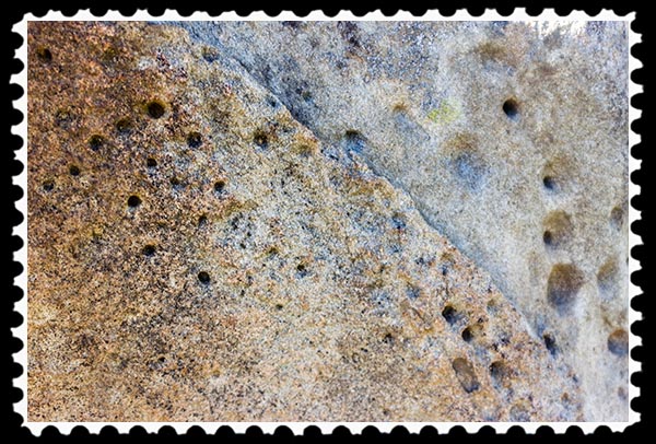
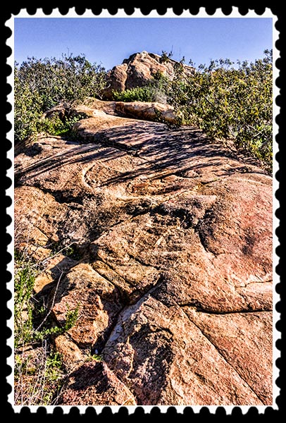
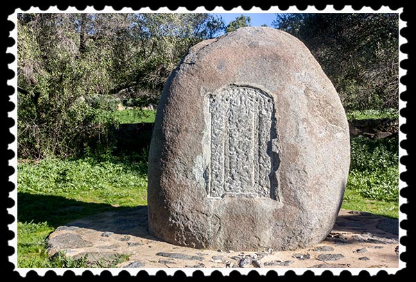
For thousands of years, the Kumeyaay ancestors of the San Pasqual Band of Mission Indians lived in the area. Many sites throughout the valleys and mountains were of religious and historical importance to them, featured in oral legends and stories. There still are remnants of the Indians’ activities in the San Pasqual Valley, such as small indentations, called cupules, in huge boulders:

Cupules at San Pasqual Battlefield State Historic Park in San Diego

Pictures copyright 2012 Russel Ray Photos

Cupules are “rock art” produced by Kumeyaay Indians. The actual meaning of the cupules is not known although in some societies small indentations were used in various youth initiation and fertility ceremonies.

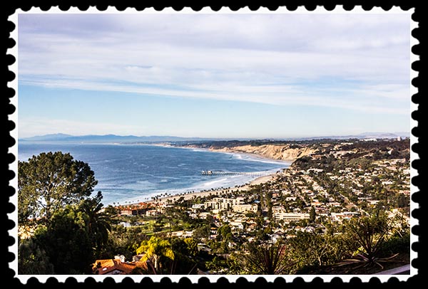
San Pasqual Valley is a large area just west of the Volcan Mountains. The valley always has served as a route into the San Diego area from points north and east, which made it valuable to both sides in the Mexican-American War. It also served as the road into San Diego County from the Southern Immigrant Trail, and from 1857 to 1860 it was part of the 125-mile stagecoach route for the San Antonio-San Diego Mail Line between the Carrizo Creek Station and San Diego.

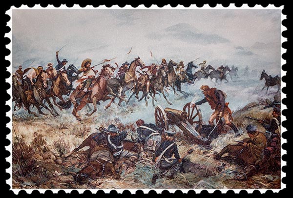
The Battle of San Pasqual occurred December 6-7, 1846, as part of the Mexican–American War (1846–48). It was the first time that the U.S. Army engaged in an extended war in a foreign land, and was instrumental in shaping the geographical boundaries of the United States. At its conclusion, the U.S. added over one million square miles of territory, including what today are the states of Arizona, California, New Mexico, and Texas, as well as portions of Colorado, Nevada, Utah, and Wyoming.

The battle was the bloodiest of the Mexican-American war. General Stephen W. Kearny’s “Army of the West”—140 American soldiers— engaged a small contingent of Mexican Californios and their Presidial Lancers Los Galgos (“The Greyhounds”), led by Major Andrés Pico.

The Army of the West had left Fort Leavenworth in what is now Kansas in June 1846. Their trek to California to help conquer it for the United States took them through the southern desert where they faced lack of water and lack of food for both them and their mounts.

The Mexican forces had lances which proved much more effective in close battle than the shorts swords of the Americans. American forces were also at a disadvantage because the gunpowder for their rifles was damp from the previous cold, rainy night.

Painting of the battle:

Battle of San Pasqual of the Mexican-American war

Pictures copyright 2012 Russel Ray Photos

After 167 years, who won the battle still is disputed. Both sides claimed victory, the Americans by holding the battlefield and the Mexicans by inflicting greater casualties. Eighteen American soldiers were killed in the battle with three others dying later of their wounds. One soldier was missing in action. The Mexican leader, Major Andres Pico, reported that only one Mexican was killed, a figure that still is disputed by Americans.

Each side achieved its objective of the battle, the Americans claiming territory and the Mexicans disabling an enemy force. History, though, generally concedes victory here to the Mexicans. The Americans began the battle as the aggressors but by the end, they had been immobilized by the Mexicans, who then held the initiative. Of course, while the Mexicans won the battle, the Americans won the war.

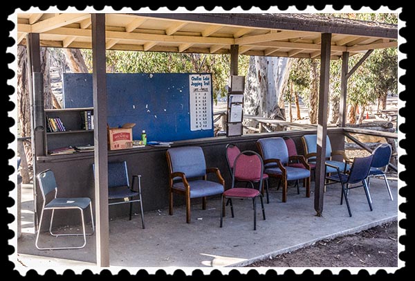
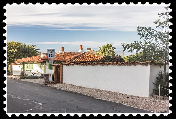
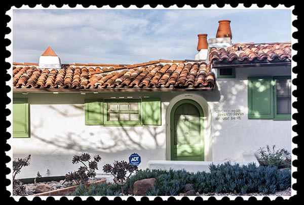
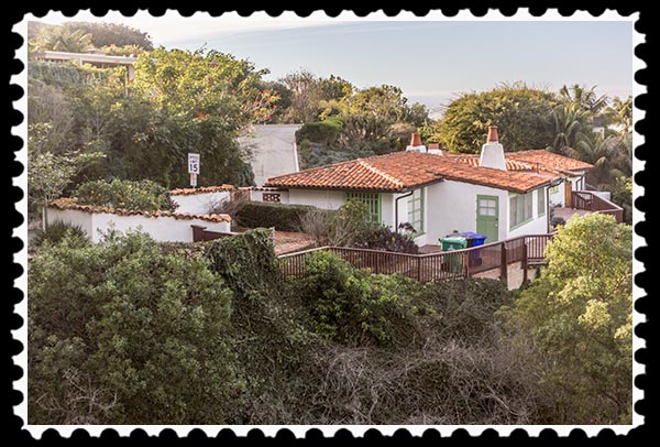
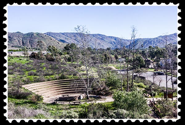
The Visitor Center is high up on the hillside:

Visitor Center at San Pasqual Battlefield State Historic Park

Pictures copyright 2012 Russel Ray Photos

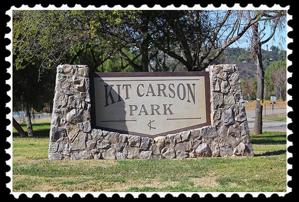
The gentleman at the Visitor Center on Saturday, January 24, was a joy to talk with. I spent about 30 minutes with him discussing the battle and some of the historical figures involved in the battle, such as General Kearny—Kearny’s name is widespread throughout San Diego County—and the already-famous Kit Carson—San Diego County’s second-largest municipal park is named after Kit Carson and is just a few miles away.

Kit Carson Park in Escondido, California

Pictures copyright 2012 Russel Ray Photos

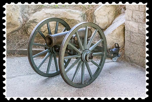
A “mountain howitzer” is on display just outside the entrance to the Visitor Center:

Mountain Howitzer

Pictures copyright 2012 Russel Ray Photos

The mountain howitzer was adopted in 1836 by the American government for use on the frontier. As a lightweight cannon of 500 pounds on 38-inch wheels, it could be quickly and easily assembled and disassembled, and could be transported on pack mules using a specially designed saddle. It could be removed from a mule, assembled, loaded, and fired in under a minute! The mountain howitzer on display used an 8-ounce powder charge to project a shell 900 yards.

Pack mules could carry up to 300 pounds a distance of 20 miles a day on a mountain trail. However, they can pull about seven times more weight than they can carry, so the mountain howitzer was designed to have shafts attached to it to allow it to easily be pulled by a mule.

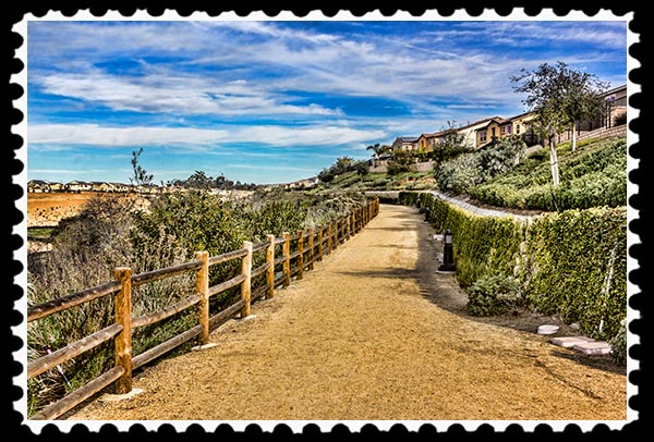
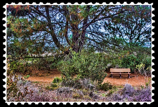
There are two trails in the park, one a quarter-mile nature trail with markers identifying native vegetation and with expansive views of the park and valley below….

San Pasqual Battlefield State Historic Park

San Pasqual Battlefield State Historic Park

San Pasqual Battlefield State Historic Park

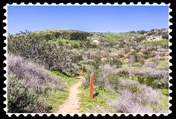
….and the other being a one-mile round trip to Battlefield Historical Monument….

San Pasqual Battlefield State Historic Park

San Pasqual Battlefield State Historic Park

Pictures copyright 2012 Russel Ray Photos

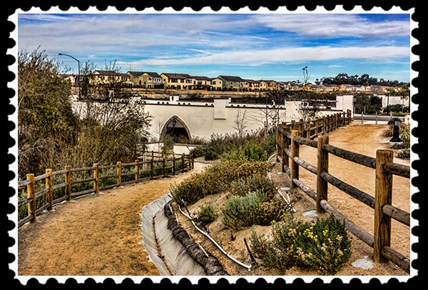
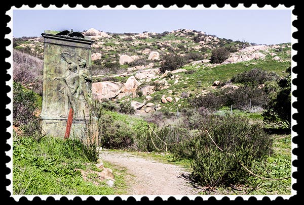
If you are not inclined for a hike, or don’t have time, you can drive to the monument site and park, which is what I did.

San Pasqual Battlefield State Historic Park

Pictures copyright 2012 Russel Ray Photos

Sadly, the bronze plaque on the largest monument had been unceremoniously stolen during the height of the Great Recession, probably taken to a recycling center and sold for scrap….

San Pasqual Battlefield State Historic Park

Pictures copyright 2012 Russel Ray Photos

Apparently the plaque had on it the names of American soldiers, but I couldn’t find out if it had all of the names or just the names of those killed in action. There are plans to replace the plaque, but not with bronze….. plastic this time, colored to look like bronze.

There is another bronze plaque a distance away from, and not seen from, the main monument boulder, which probably is what resulted in its bronze plaque not being stolen.

San Pasqual Battlefield State Historic Park

Pictures copyright 2012 Russel Ray Photos

Most of the San Pasqual Valley is now part of the San Pasqual Valley Agricultural Preserve, home to citrus, avocado, and dairy farms, as well as the San Pasqual Valley American Viticultural Area. American Viticultural Areas are defined by the Alcohol and Tobacco Tax and Trade Bureau of the United States Department of the Treasury.

That sounded serious!

Since I had no idea what a Viticultural Area was, I went to Wikipedia and found that it is a region that grows wine grapes. Wow! The government is involved in regulating areas that grow grapes for wine. I’ll just leave it at that….

img_9387 stamp

Pictures copyright 2012 Russel Ray Photos

The Visitor Center is open only on Saturdays and Sundays from 10:00 a.m. to 5:00 p.m. Temperatures can get extraordinarily hot (often in triple digits!) during summer days, so prepare appropriately with a good supply of water and outerwear to protect you from the sun.

On December 6 each year the park holds “Battle Day” to commemorate the Battle of San Pasqual. This year that’s a Sunday, which means I put it on my calendar.

Also located within the park boundaries is the San Diego Archaeological Center and the San Pasqual Indian Cemetery. I did not have time to visit them during this trip but you know I will, with my handy dandy Canon camera in tow!

For the introductory blog post
to San Diego’s historical landmarks,
click on San Diego’s Historical Landmarks.

For previous posts in the
San Diego Historical Landmarks series,
go here.

Pictures copyright 2012 Russel Ray Photos

Need a unique gift?
Anniversary? Birthday? Graduation? Marriage?
Choose Photographic Art by Russel Ray Photos at Fine Art America.

Photographic Art logo

Pictures copyright 2012 Russel Ray Photos

I'm Zoey the Cool Cat, and I approve this post

Out & About—Manzanita Trail in San Diego’s Pacific Ranch Highlands

Out & About

Saying that something is located in San Diego can be misleading since San Diego stretches from the Mexico border to the Safari Park, a distance of about 70 miles north to south and a total area of about 372 square miles.

The other day I was teaching chess at Solana Ranch Elementary, about 25 miles north of downtown San Diego yet still in the city of San Diego. I got there later than usual so I had to park a few billion miles away from the school and walk.

That walk, however, allowed me to find the Manzanita Trail. After class, still with 90 minutes of daylight left, I went to explore. Here is some of what I found on my short one-mile hike:

Manzanita Trail in Pacific Highlands Ranch in San Diego

Pictures copyright 2012 Russel Ray Photos

Manzanita Trail in Pacific Highlands Ranch in San Diego

Pictures copyright 2012 Russel Ray Photos

Manzanita Trail in Pacific Highlands Ranch in San Diego

Pictures copyright 2012 Russel Ray Photos

I had a specific goal because I kept seeing a cool building from a distance. That cool building was not a building at all. Instead, it was an underpass, possibly ranking as the coolest hiking path under a road that I’ve ever seen. You take the high road and I’ll take the low road….

Manzanita Trail in Pacific Highlands Ranch in San Diego

Pictures copyright 2012 Russel Ray Photos

Manzanita Trail in Pacific Highlands Ranch in San Diego

Pictures copyright 2012 Russel Ray Photos

Manzanita Trail in Pacific Highlands Ranch in San Diego

Pictures copyright 2012 Russel Ray PhotosManzanita Trail was created by the subdivision’s HOA. I found it on Google Maps, and it seems to go on forever. I suspect that in some areas it has a name change, the complete trail being a consortium of smaller trails like Manzanita.

Manzanita Trail

Pictures copyright 2012 Russel Ray Photos

Need a unique gift?
Marriage? Anniversary? Birthday? Special event?
Photographic Art logo
Choose Photographic Art by Russel Ray Photos

I'm Zoey the Cool Cat, and I approve this post

Out & About—San Elijo Lagoon Ecological Reserve in Encinitas, California

Out & About

I remember the first time I heard the word Lagoon. Such a funny-sounding word. I was 7 or 8, living in Brigham City, Utah, at the time, and we were going to Lagoon, which was an amusement park in Farmington, 44 miles south of Brigham City and 17 miles north of Salt Lake City.

A couple of weeks ago, grade schools started up again after the end-of-year break, which meant that after-school enrichment programs would be starting up, too. I teach chess in five grade school enrichment programs.

One of the schools that I will be teaching at this term is a new school for me. Whenever I have a new school, I get there early to find parking, check out the neighborhood, get through the school’s security protocols, and find my room. This time, I got there way too early. I think many people were still on end-of-year vacation, so freeway traffic was very light.

As I was driving around the neighborhood looking for photography subjects, I found a little cul-de-sac with lots of brush, trees, and a little trail. Ah, trails. I just can’t resist trails. I parked the car, grabbed my camera, and went for a little hike.

I had not gone too far when I saw a couple of signs:

San Elijo Lagoon in San Diego, California

San Elijo Lagoon in San Diego, CaliforniaPictures copyright 2012 Russel Ray Photos

I saw several rattlesnakes and one mountain lion:

Twin-spotted Rattlesnake

Mountain lion

Pictures copyright 2012 Russel Ray Photos

Sadly, the rattlesnakes and mountain lion that I saw were at the San Diego Zoo the next day. That’s why I love the Zoo and SeaWorld—I get to see wildlife that I would never see otherwise.

I didn’t hike very far because I could see that the trails seemed to go on and on and on. (Hmmmm. Maybe the Energizer Bunny is out there somewhere.) I couldn’t get lost in the menagerie and not make it back to school on time to teach chess to that wildlife known as “rugrats.”

I did come upon a lonely bench, which turned out to be very photogenic:

Lonely bench

Lonely bench

Pictures copyright 2012 Russel Ray Photos

When I got home, I used Google Maps to determine that I was on the outer edges of San Elijo Lagoon Ecological Reserve.

Pictures copyright 2012 Russel Ray Photos

San Elijo Lagoon Ecological Reserve is one of the largest remaining coastal wetlands in San Diego County, comprising 915 acres. There are six plant communities within the Reserve: coastal strand, salt marsh, freshwater marsh, riparian scrub, coastal sage scrub, and mixed chaparral. The diversity of wildlife is enormous: more than 300 species of plants, at least 23 species of fish, 26 mammal species, 20 reptiles and amphibians, more than 80 invertebrates, and 300 bird species.

San Elijo Lagoon is part of the Escondido Creek Watershed, comprising about 54,000 acres, stretching from the foothills to the coastline. It includes the last remnants of an imperiled coastal scrub habitat connecting the northern and southern parts of a globally important ecological region. The coastal scrub habitat is vital to the persistence of some of Southern California’s most endangered species, many of which occur nowhere else on Earth.

All of which means that, of course, I shall be making a more extensive visit sometime soon.

img_9301 stamp

Pictures copyright 2012 Russel Ray Photos

Need a unique gift?
Marriage? Anniversary? Birthday? Special event?
Photographic Art logo
Choose Photographic Art by Russel Ray Photos

This post approved by
Zoey the Cool (Book) CatI'm Zoey the Cool Cat, and I approve this post

Out & About—Pottery Canyon Natural Park in La Jolla, California

Out & About

My wise old grandmother introduced me to the joys of gardening, so anytime I see a plant nursery or anything related to plants, including pottery, I tend to stop and take a look.

When I found Pottery Canyon Natural Park in La Jolla, a little sign was zooming by me at about 50 miles per hour…………Wait. Maybe I was zooming by it………!

Therein is the problem. The poorly marked entrance to Pottery Canyon Natural Park is on a curve on one of La Jolla’s busiest roadways. If you don’t plan your method of attack appropriately…. an accident in the making. Not only that, but Pottery Canyon Natural Park is not on any map anywhere. Here’s where it is, though:

Location of Pottery Canyon Natural Park in La Jolla, California

Pictures copyright 2012 Russel Ray Photos

The little stub of a street on the right side of Torrey Pines Road is Pottery Park Driveway. Although there is a traffic signal there, I have never been through there on Torrey Pines Road where the signal was anything other than green with cars going up the hill at 50 mph or more. That presents a problem if you’re coming out of Pottery Park Driveway because the light is always red for the Driveway and traffic on the other side going south backs up from all the traffic signals at the messy Torrey Pines Road/La Jolla Parkway intersection. As you’re leaving the Park, I recommend turning right and going north to La Jolla Village Drive to get back to Interstate 5. Otherwise, plan on a long wait at the traffic signal in order to go south.

Pottery Park Driveway leads to a small parking lot big enough for four motorcycles or two Mini Coopers or one 2002 Toyota Camry V6, black.

With that said, what did I find at Pottery Canyon Natural Park? Well, it’s a eucalyptus grove with a hiking trail that is wide, mulched, and short, maybe a half mile, round trip. Easily hiked. Heck, even my husband, Jim, went hiking with me and he’s not the outdoorsy type like me.

That’s it.

Pottery Canyon Natural Park in La Jolla, California

Pictures copyright 2012 Russel Ray Photos

There is history behind this little park, though. According to research, there is a sign about the history. I couldn’t find the sign, which is kind of odd since the park is so small. Nonetheless, according to the La Jolla Historical Society, here’s what the sign apparently says:

Cornelio Rodriguez, an accomplished potter, came to La Jolla in 1928 from Tomatlan in the state of Jalisco, Mexico. He was looking for a suitable site where he and his brothers, Abraham and Ubaldo, could start a pottery works. Here, at the bend of what was then called La Jolla Canyon Road and which was the main route to Los Angeles, he found potter’s gold, the perfect clay deposit, otherwise known as “barro.”

Mission San Diego de AlcalaHe purchased the property, and he and his brothers established the La Jolla Canyon Clay Products Company and built it and their houses here. Their families and their company flourished. They produced handmade roof tiles, unglazed floor tiles, and adobe brick for more than 20 years. Tiles used in the restoration of Mission San Diego de Alcala [picture ►], the construction of the La Jolla Beach & Tennis Club and La Jolla’s Mary Star of the Sea church came from here, as did the roof tiles of numerous houses of the Mission Revival architectural period.

In the 1950s, the brothers were no longer able to use the large oil-fired kiln of earlier days. Many in the large family moved, but Abraham and Cornelio lived out their days here. Cornelio and his wife, Matiana, continued making pots and other clay products on a more limited scale. Using hand-dug clay shaped on a potter’s wheel and fired in a circular wood-burning kiln of ancient Roman design, they supplied the community with unique pottery and delighted generations of school children with deomnstrations of their skill.

All that remains of the original tile works is the old wood-burning kiln, which continued in use until the 1980s.

Sadly, I did not find the old wood-burning kiln either. The missing sign and kiln makes me wonder how long ago that was written by the La Jolla Historical Society.

Pottery Canyon Natural Park in La Jolla, California

Pottery Canyon Natural Park in La Jolla, California

Pottery Canyon Natural Park in La Jolla, California

Pictures copyright 2012 Russel Ray Photos

Need a unique gift?
Marriage? Anniversary? Birthday? Special event?
Photographic Art logo
Choose Photographic Art by Russel Ray Photos

This post approved by
Zoey the Cool (Book) CatI'm Zoey the Cool Cat, and I approve this post

Little Free Libraries in San Diego County

Out & About

Little Free Libraries are a community movement that offers free books housed in small containers to members of the local community. They are also referred to as community book exchanges, book trading posts, pop-up libraries, and Noox (Neighbourhood bOOk eXchange).

The Little Free Library phenomenon, according to Wikipedia, started in 2009 in Hudson, Wisconsin.

“Todd Bol mounted a wooden container designed to look like a school house on a post on his lawn as a tribute to his mother, who was a book lover and school teacher.”

Recently I found a Little Free Library at Chollas Lake, but it also has nice chairs to sit in!

Little Free Library

Little Free Library

Pictures copyright 2012 Russel Ray Photos

Quoting Wikipedia again:

Little Free Library owners can create their own library box, usually about the size of a doll house, or purchase one from the [Little Free Library website]. Libraries may be registered for a fee and assigned a number at the organization’s website. Libraries can be found through their GPS coordinates. Owners receive a sign that reads “Little Free Library”. They often have the phrase, “Take a Book. Leave a Book.”

As of February 2013, all 50 states and 40 countries worldwide have been involved in the literary program.[6

The original goal was the creation of 2,150 Little Libraries, which would surpass the number of libraries founded by Andrew Carnegie. As of January 2014, there are over 15,000 Little Libraries worldwide, including all 50 states and 40 countries.

Here is a list of Little Free Libraries that I know of as of January 25, 2015:

2727 Southampton Road, Carlsbad
2357 Summerwind Place, Carlsbad
4190 Sunnyhill Drive, Carlsbad
2605 Unicornio Street, Carlsbad
911 Rutgers Avenue, Chula Vista
601 Crescent Drive, Chula Vista
200 Stratford Court, Del Mar
1902 Quidort Court, El Cajon
1332 Whitsett Drive, El Cajon
1650 Sunburst Drive, El Cajon
107 Woodshadow Lane, Encinitas
744 Quiet Hills Farm Road, Escondido
2356 Heather Point, Escondido
660 East Grand Avenue, Escondido
1263 Canter Road, Escondido
611 El Norte Hills Place, Escondido
1683 Calle Candela, La Jolla
Little Free Library4622 Grandview Terrace, La Mesa
10733 Itzamna Road, La Mesa
4424 Nabal Drive, La Mesa
4351 Parks Avenue, La Mesa
4630 Palm Avenue, La Mesa (picture ►)
10615 Snyder Road, La Mesa
317 Hoover Street, Oceanside
16285 Oak Creek Trail, Poway
13130 Woodmont Street, Poway
12133 Sage View Road, Poway
13423 Cricket Hill, Poway
3412 Quince St, San Diego
2611 Grandview St, San Diego
3343 Harbor View Drive, San Diego
2263 Pentuckett Avenue, San Diego
4963 Canterbury Drive, San Diego
1079 Cypress Avenue, San Diego
3314 Karok Avenue, San Diego
2153 Pine Street, San Diego
2731 Amulet Street, San Diego
12655 Pacato Circle South, San Diego
4523 Cather Avenue, San Diego
815 Avalon Court, San Diego
10444 Cheviot Court, San Diego
4567 East Talmadge Drive, San Diego
5854 Malvern Court, San Diego
3530 Cooper Street, San Diego
2341 Whitman Street, San Diego
4649 Biona Drive, San Diego
9505 East Harland Circle, Santee

If you have a Little Free Library, you can register it to make it official.

Little Free Library

Pictures copyright 2012 Russel Ray Photos

Need a unique gift?
Marriage? Anniversary? Birthday? Special event?
Photographic Art logo
Choose Photographic Art by Russel Ray Photos

This post approved by
Zoey the Cool (Book) CatZoey the Cool Cat exploring the books

The Birds

Out & About

When I was eight and living in Brigham City, Utah, mom and dad came home one afternoon talking about the birds. I have always loved birds, and all animals actually, but what they were saying about the birds really had me upset. I couldn’t picture birds attacking people, killing them, and eating them. That’s not like any birds I’ve ever seen. Eventually I found out that they were talking about a movie.

Ah, movies. A couple of friends and I used to sneak into the local movie theater to watch movies free since we couldn’t afford the 25¢ ticket.

Ever since then, whenever I’m in the midst of billions and billions of birds, I think of Alfred Hitchcock and “The Birds.”

So when I was at Chollas Lake Park the other day feeding the birds, yep, flashbacks.

Pictures copyright 2012 Russel Ray Photos

Pictures copyright 2012 Russel Ray Photos

Need a unique gift?
Marriage? Anniversary? Birthday? Special event?
Photographic Art logo
Choose Photographic Art by Russel Ray Photos

I'm Zoey the Cool Cat, and I approve this post

My margarita pie recipe for National Pie Day on 1/23/15

Did you know?

This coming Friday, January 23, is National Pie Day!

My civic duty requires that I share my recipe for margarita pie:

Ingredients:

4 cups vanilla ice cream, softened
½ cup thawed lemonade concentrate, undiluted
¼ cup tequila
2 tablespoons triple sec
1 6-ounce graham cracker crumb crust

Freeze a glass or metal bowl for 30 minutes.
Immediately add first 4 ingredients to bowl; stir well.
Return to freezer for 30 minutes.
Spoon partially frozen mixture into crust and cover.
Freeze for 4 hours.

Yields: 8 servings

Nutrition facts

Margarita pie caution

Margarita pie

Pictures copyright 2012 Russel Ray Photos

Need a unique gift?
Marriage? Anniversary? Birthday? Special event?
Photographic Art logo
Choose Photographic Art by Russel Ray Photos

I'm Zoey the Cool Cat, and I approve this post

Out & About—The La Jolla Munchkin House

Out & About

There is so much to see and do in La Jolla. After 21½ years living in the San Diego area, I’m still going to La Jolla to see and do things.

Recently I made a trip to La Jolla just to see the famous Munchkin House. Looks like this:

The Munchkin House of La Jolla, California

Pictures copyright 2012 Russel Ray Photos

The Munchkin House of La Jolla, California

Pictures copyright 2012 Russel Ray Photos

The Munchkin House of La Jolla, California

Pictures copyright 2012 Russel Ray Photos

There used to be four of these Munchkin Houses, and there are many rumors about them, foremost of which is that after the success of “The Wizard of Oz” movie, released in August 1939, several “Munchkins” took their earnings and built four houses high up on the hillside overlooking La Jolla, houses that were not as tall as traditional homes.

Sadly, the facts aren’t near as exciting as the rumors.

IMG_9271 framedThe last of the remaining houses is located at 7477 Hillside Drive in La Jolla. Public records indicate that the house was built in 1935. That right there destroys the rumor that Munchkins took their earnings from a 1939 movie and had the houses built.

The house was designed by noted architect Cliff May (1909-1989). May grew up in San Diego and is best known for developing the suburban post-war dream home, the California Ranch House. He designed over 1,000 custom residences, and over 18,000 tract homes bear the imprint of his model house prototypes. He died at his mansion in Los Angeles in Brentwood, a neighborhood made famous worldwide by O.J. Simpson in 1994.

The Munchkin House has 1,176 square feet, two bedrooms and one bathroom, and was last sold in August 2003 for $975,000. Although 1,176 square feet certainly is small for a La Jolla home, look at the rear of the house—love the wraparound deck!—as well as the sweeping view it has of La Jolla and the Pacific Ocean:

The Munchkin House of La Jolla, California

Pictures copyright 2012 Russel Ray Photos

Ocean view from The Munchkin House of La Jolla, California

Pictures copyright 2012 Russel Ray Photos

The other reason why the Munchkin rumors hold water (pun intended) is due to the lay of the land. I could easily touch the top of the roof without jumping. The house is built into the hillside, so some of it is below street level, leading to the optical illusion that the home’s height is lower than normal, perfect for Munchkins!

Look at the first picture, paying close attention to the doorway. See the path from the street to the door, below ground level? Then look at the window north of the doorway. See how the ground slopes up, making it look like the window is not as high as normal? It’s just closer to the ground is all.

Pictures copyright 2012 Russel Ray Photos

Need a unique gift?
Marriage? Anniversary? Birthday? Special event?
Photographic Art logo
Choose Photographic Art by Russel Ray Photos

I'm Zoey the Cool Cat, and I approve this post

Out & About—The La Jolla tide pools

Out & About

Any time is a great time to visit the San Diego coast, but when the low tides get really low, it’s time for a visit to the various tide pools along the coast. One of the best is the La Jolla Tide Pools.

Pictures copyright 2012 Russel Ray Photos

La Jolla Tide Pools, San Diego, California

Pictures copyright 2012 Russel Ray Photos

La Jolla Tide Pools, San Diego, California

Pictures copyright 2012 Russel Ray Photos

La Jolla Tide Pools, San Diego, California

Pictures copyright 2012 Russel Ray Photos

La Jolla Tide Pools, San Diego, California

Pictures copyright 2012 Russel Ray Photos

La Jolla Tide Pools, San Diego, California

Pictures copyright 2012 Russel Ray Photos

La Jolla Tide Pools, San Diego, California

Pictures copyright 2012 Russel Ray Photos

La Jolla Tide Pools, San Diego, California

Pictures copyright 2012 Russel Ray Photos

La Jolla Tide Pools, San Diego, California

Pictures copyright 2012 Russel Ray Photos

La Jolla Tide Pools, San Diego, California

Pictures copyright 2012 Russel Ray Photos

La Jolla Tide Pools, San Diego, California

Pictures copyright 2012 Russel Ray Photos

La Jolla Tide Pools, San Diego, California

Pictures copyright 2012 Russel Ray Photos

The lowest of the low tides, and the highest of the high tides, present the best opportunities to see (low tide) or witness (high tide) things that normally can’t be seen or witnessed. To find the low and high tides for San Diego, visit San Diego Tides.

Pictures copyright 2012 Russel Ray Photos

Need a unique gift?
Marriage? Anniversary? Birthday? Special event?
Photographic Art logo
Choose Photographic Art by Russel Ray Photos

I'm Zoey the Cool Cat, and I approve this post.

San Diego beach houses of the extraordinarily wealthy

Picture of the Moment

Yesterday afternoon’s low tide was one of the lowest we’ll have in January, which means that the tide pools along the coast required a visit.

Depending on where you go to see the tide pools, sometimes the little ol’ beach houses command one’s attention, like these two beach houses in La Jolla:

San Diego beach houses

Click on the image for a larger version.

La Jolla is one of San Diego County’s enclaves of the rich and famous. In 2008 & 2009, La Jolla had the highest home prices in the nation, an average price around $2 million.

It’s one of the places politicians stay when they come to San Diego.

John McCain owns a home in La Jolla…. Mitt Romney lives there. Racquel Welch…. Robin Wright Penn…. Shane Harper….

There are rich Republicans and rich Democrats there. Probably some rich Independents, rich Atheists, rich Wiccans, and rich Satanists….

La Jolla, California

Pictures copyright 2012 Russel Ray Photos

Location of the two beach houses:

La Jolla beach houses

Pictures copyright 2012 Russel Ray Photos

I'm Zoey the Cool Cat, and I approve this post