Monthly Archives: March 2017

Training for women teaches them to keep their boobs out of the way

Out & About

As much as I love taking pictures of industrial stuff, I rarely hang around industrial areas. It might have something to do with the dirt, noise, and traffic.

Last year when I was delivering packages for Amazon Prime Now and people for Uber, I was forced to go through and into some industrial areas that I never ever would have gone through or into before. That’s when I discovered that one can go to the University of Iron and get a “degree” in iron work. Who knew?

University of Iron San Diego

University of Iron San Diego

University of Iron San Diego

The University of Iron offers training for Apprentices and re-training for Journeymen. They even have training for women! Imagine that. I guess training for women teaches them how to keep their boobs out of the way…..

My grandfather and one of my uncles taught me iron work when I was a teenager back in the ’60s and ’70s. I helped build iron and steel barns both for members of my family in South Texas and neighbors who saw what we were doing and wanted us to build them a bigger and better barn that would withstand hurricanes and tornadoes. We did build them bigger and better but they came with no wind-survival guarantees. In looking at Google Street and Google Earth, I do see that many of the barns I helped build 45+ years ago are still standing.

Being forced to build all those barns, though, was when I definitively decided that I was going to college because I had no intent of doing such hard manual labor for the rest of my life. Now one can go to college to learn how to do all that hard manual labor. I just wonder, though, “What was the last bowl game that the University of Iron football team went to, and did they win or lose?”

Thanks for stopping by! See you next time!

This post approved by
This post approved by Zoey the Cool Cat

How I Did It—Works for me

How I Did It

I pretty much try to abide by the rule of thirds when I take pictures. I think it creates more aesthetically pleasing photographs.

The rule of thirds might be the most well-known rule of photographic composition since it is one of the first things one learns in photography class.

Of course, rules are meant to be broken, but if you’re going to break a rule, make sure you know it very well so that breaking it is even more effective.

The basic principle behind the rule of thirds is to imagine breaking an image down into thirds (both horizontally and vertically) so that you have 9 parts:

Rule of thirds

The exact center rarely is a good place to put your focal point unless your intent is to show symmetry. Too high, too low, too far left, or too far right is kind of like dissonance in music; it just doesn’t feel right/sound right/look right. The grid, then, identifies four areas of the image—where the lines intersect—where you should consider placing points of interest in your picture.

Along with the four intersections, the rule of thirds also gives you four lines along which to place elements in your picture.

Rule of thirds lines

The theory behind the rule of thirds is that placing points of interest at the intersections or along the lines provides a more balanced picture with which the viewer can interact more naturally. Apparently, research shows that when looking at a picture, your eyes go naturally to one of the intersections much more naturally than to the center of the image.

I don’t know if the rule of thirds comes naturally to me or whether fifty years of photography has simply made it a habit. Maybe I’ll intentionally break the rule to see what happens.

If your picture looks or feels awkward, don’t hesitate to take it into a digital photo editing program like Photoshop and crop it to give it a better feel or look.

Following is a panorama of the Music Building at San Diego State University that illustrates the rule of thirds. This panorama was created by taking 8 separate pictures into Photoshop and then using the Photomerge function to stitch them together. Afterwards I cropped the panorama to get this:

Music Building at San Diego State University

My landscape-oriented pictures often use the top, middle, and bottom thirds, as I have done that picture. I really like this picture, first and foremost because it’s the Music Building and connects with my 60 years of music (violin, piano, and voice). Additionally, though, I really like the dominant but different colors in the thirds—blue in the upper third, white in the middle, and green in the lower. Notice, however, that the transitions are not too sharp or abrupt. The white clouds in the blue sky lead one’s eyes to the white building. The green trees against the white building then lead one’s eyes to the green grass in the lower third. In every sense, this picture works for me.

Thanks for stopping by! See you next time!

This post approved by
This post approved by Zoey the Cool Cat

Out & About—Cruise historic Highway 80

Out & About

More sights from my driving tour of Old Highway 80 through East San Diego County.

Cruise Highway 80

The Alpine Town Hall (two pictures below) was built in 1899 and served through 1999. Alpine began in the 1870s as a local center for ranching. The building currently is owned by the Alpine Woman’s Club which pretty much has to missions: to preserve the town hall and to provide scholarships to Alpine graduating seniors heading to college.

Alpine town hall in Alpine CA

Alpine town hall in Alpine CA

The Descanso Junction Restaurant is quite popular. I was there around 8:00 a.m., and it was packed. Descanso Junction’s original name was Bohemia Grove, and the original name of the restaurant was El Nido. That’s my car at the left parked next to the truck.

Descanso Junction Restaurant

The Descanso Town Hall was built in 1898. It still is a popular venue for local events and is one of the few community halls still operating in the mountains.

Descanso Town Hall

The Perkins Store has been in operation since 1875. The store in the picture below was built in 1939 after the original store burned.

Perkins Store

The old Guatay Service Station dates from the 1920s but is now just a shell of its former self. The round metal shed was the service bay.

Ruins of the Guatay Service Station

Behind the service station ruins sits a cool stone house, also built in the 1920s and still being used as a private residence.

Stone house

The immensely popular Frosty Burger in Pine Valley occupies another 1920s-era service station. I can highly recommend Frosty Burger. It can get cold in the high desert mountains, and Frosty Burger has only outdoor seating, so take a jacket or plan on eating in your warm car.

Frosty Burger in Pine Valley

The Pine Valley Inn was the main business in Pine Valley for many years. The main dining hall (right in the picture below) is still used as a restaurant, and the rental cabins, although remodeled and updated, still are in use. One of the rental cabins can be seen at the left.

Pine Valley Inn

Thanks for stopping by! See you next time!

This post approved by
This post approved by Zoey the Cool Cat

Out & About—Thank you, Amy. You’re great!

Out & About San Diego

El Cajon Boulevard in San Diego currently is signed as a business loop for Interstate 8. Prior to that, it was the principal thoroughfare from San Diego to El Cajon and points farther east as U.S. Highway 80. In the ’50s and ’60s it was known locally simply as
“The Boulevard” and was the cruising strip where high school and college  students went to see and be seen.

I drive El Cajon Boulevard quite often, but since it’s a heavily used, I’m usually watching traffic instead of looking at sights. In early January when I decided to take a driving tour of what remains of U.S. Highway 80, now called “Old Highway 80” or “Historic Route 80,” my tour started at the corner of Park Boulevard and El Cajon Boulevard. My goal was to see sights, traffic be darned.

One of the earliest stops on the tour was 3727 El Cajon Boulevard, a 5-story building with a huge mural on the corner:

Mural at 3727 El Cajon Boulevard, San Diego, California

Mural at 3727 El Cajon Boulevard, San Diego, California

Other than the mural showing old cars on El Cajon Boulevard and a California US 80 sign, I have not been able to find out anything else about it. The building, however, is the historic Bekin Building. It originally was constructed as a storage facility for Bekins Van Lines, founded in 1891 in Indianapolis, Indiana, and used by Bekins for several decades.

Currently it hosts a variety of light manufacturers, office dwellers, artists, and creative craftsman. Tenants include The Boulevard Business Improvement Association, a cabinet shop, several upholsterers, a mid century modern furniture reseller, an industrial lighting designer, and several Etsy & Ebay professionals.

According to public records, the building has 31,500 square feet and was built in 1941. The property is zoned warehouse industrial. Interestingly, the current owner is R&C Bekins LLC. R&C Bekins does not appear to be related to Bekins Van Lines, and the company was founded just a couple of weeks before buying the building. I’m thinking that the owner of R&C Bekins, Amy Campagna, had a soft spot for Bekins and this building and decided to buy it. Maybe she worked there for many years.

According to sources, her intent is to provide an affordable and unique environment with a flexible range of spaces to house small businesses and creative persons. With property taxes on this building being in the $30,000 range annually, I can’t believe that she makes enough money from rents to pay both the taxes and the mortgage on the building, so all I have to say is, “Thank you, Amy. You’re great!”

Thanks for stopping by! See you next time!

This post approved by
This post approved by Zoey the Cool Cat

Halls of History—Then the tax bills started arriving

Halls of History

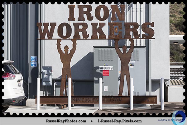
I always have done a lot of reading. People have always asked me how I had so much time for reading. I call it multitasking.

When I was in college at Texas A&M University, the lines were long for football tickets, Aggie rings (called “senior rings” at other schools), and the Aggieland (called “yearbooks” at other schools). I learned to take a book or magazine with me to read while waiting in line. Most of the time it was a textbook back then—priorities, you know.

In today’s world, magazines pretty much don’t exist anymore, so Books R Us. I’m usually reading two concurrently, a history book and a fiction book (Stephen King, Lee Child, Lincoln Child, etc.).

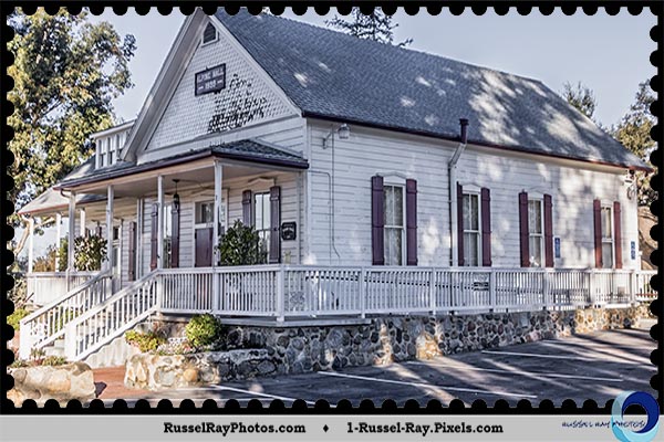
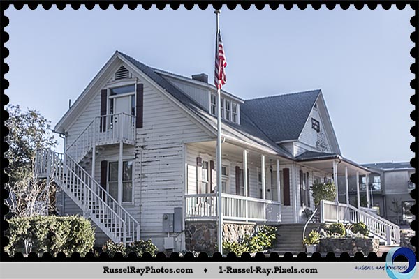
The history book I’m reading right now is a history of the area where I currently live: Our Hills and Valleys: A History of the Helix-Spring Valley Region by Thomas Joseph Adema. Here are some tidbits, excerpts, and thoughts:

Picture it. Early 1930s.

Great Depression. You are barely surviving.

You own four acres of land. Your property tax bill arrives.

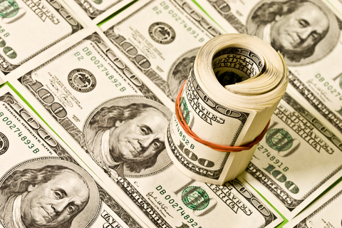
$1,200. Four times what the land and home are worth.

What are you going to do? Why, stop paying taxes, of course. The Mattoon Act will take care of you.

Must have been the greatest law ever, right? Can’t pay your property taxes? Fall back on The Mattoon Act.

San Vicente DamThe Acquisition and Improvement Act, its proper name, was passed by the California legislature in May 1925. The bill was intended to streamline the process for, and provide funding for, the construction of needed public works—paved streets, lighting, bridges, reservoirs, better and more reliable water delivery.

Property condemnation was quicker and easier. Community authorities had the power to create “improvement districts” that crossed city and county lines. Thus, if a new sewer line was needed, the areas benefiting were designated “improvement areas.” Bonds were sold to fund the construction, and landowners in the improvement district would pay off the bonds with a yearly ad valorem tax.

Real estate developers loved the law. They used public funds to install street lamps, build parks, and widen and pave roads in their newly subdivided neighborhoods. City councils and utility companies also loved it.

Homeowners initially liked the law because their neighborhoods were improved, but they had no choice about which improvement districts they were thrown into. It was entirely possible that if you lived at the boundary of three cities, you could be in three improvement districts.

Meeting of La Mesa, Lemon Grove, and Spring Valley CA
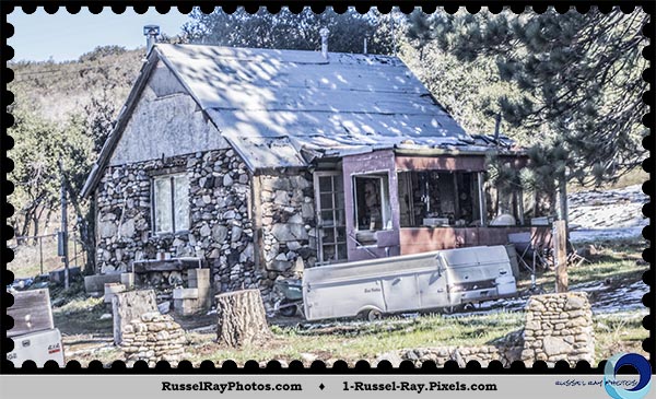
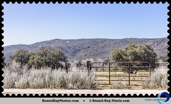
As an example, I live at the corner of the boundaries for La Mesa, Lemon Grove, and Spring Valley. Imagine all of them putting me in their improvement districts and taxing me for anything and everything from which I might benefit as a member of the public. Then throw in that suddenly I am unemployed and the nation is in the midst of a Great Depression. Sunk, I would be.

Then the tax bills started arriving.

The killer provision in The Mattoon Act said what would happen if one could not pay one’s taxes: The rest of the members of the improvement district would have to pay them.

So if Johnny could not pay his taxes, no big deal.

Back in the days of The Mattoon Act, Spring Valley had ten households. When Johnny could not pay his $1,200 tax bill in 1927, his tax bill was split between the other nine households.

Joe, after paying his $1,200 tax bill, suddenly got another tax bill for $133.33, his share of Johnny’s bill. Joe couldn’t pay the additional $133.33, so his tax bill was split between the other eight households.

Mary, after paying her $1,200 and her $133.33 share of Joe’s bill, now got yet another tax bill for $16.66. On and on it went.

Spring Valley CAHomes were lost to foreclosure for failure to pay taxes, or tax liens were placed on their homes, making it impossible to sell the property. Homes fell into disrepair, making them even more difficult to sell.

It didn’t take long before the population rebelled, and The Mattoon Act was repealed in 1931. The damage had been done to many people and many cities and for many years to come. People lost their land and homes but there was no one to buy them so the cities were left with land but no money to pay the bonds on the projects they already had completed. Oh what a tangled web….

In 1935, the United States Supreme Court ruled that The Mattoon Act had been legal, so cities and taxpayers still had to pay the debts which had incurred. It took several years before cities and taxpayers were tax free.

Targeted relief plans were passed, including a gas tax to pay off road bonds. Landowners were given final sums that they could settle with cash. In the case of Johnny, whose home had been foreclosed back in 1927, he got his home back by paying $250 to settle the tax bill.

Money

Thanks for stopping by! See you next time!

This post approved by
This post approved by Zoey the Cool Cat

Out & About—I guess they are planning for a population boom

Out & About

The first time I went to the Mojave Desert was during the Summer of 1973 when I went with two friends (Jaime and Larry) on a tour of the United States west of the Mississippi River. Since we lived in South Texas, a desert in its own right, the Mojave didn’t really interest me, at least not near as much as San Francisco, Oakland (home of the Raiders and A’s), Los Angeles, and San Diego. The only reason we were going there was to visit Death Valley, which has the lowest point in the lower states and the highest recorded temperature of 134°F (July 10, 1913).

Now that I am a couple of years older, I have a greater appreciation for the deserts, finding them quite interesting. For some reason, though, they still are quite hot, so i don’t visit them often.

In early February, I was in the western reaches of the Mojave Desert tracking trains that have to get through the desert to points east. Here are a few pictures of what I found in the Mojave Desert:

California Aqueduct & Lake PalmdaleCalifornia Aqueduct & Lake Palmdale

Seems kind of odd to build an open-air aqueduct in one of the hottest places on Earth.

The desert seemed to be one huge dumping ground. Trash was everywhere, and I’m not talking about litter. I’m talking about huge items abandoned as trash. The beauty of the Mojave Desert was ruined in so many places.

Sofa bed dumped in the desert

Trash in the Mojave Desert

Trash in Mojave Desert

Winfield’s Custom Shop had the most interesting advertising sign.

Winfield's Custom Shop

When Winfield says “custom,” I think he means it. Check out this custom police car:

Custom police car

Wind farms were everywhere. Many people find them ugly but I find them strangely fascinating and beautiful.

Mojave Desert wind farm

Notice the snow-capped mountains in the picture above. This is the high desert, and although it gets extraordinarily hot and has little precipitation, the mountain peaks are high enough that they can get snow on them in the winter.

I saw Edwards Air Force Base where the Space Shuttle would land when bad weather prevented a Florida landing at Cape Canaveral. More snow-capped mountains in the distance.

Edwards Air Force Base

My little hometown of Kingsville TX had numbered streets all the way up to 17th Street, paved with concrete and asphalt, and houses lining both sides of the street. Out in the Mojave Desert, it’s a little different.

233rd Street East

233rd Street East

You might be inclined to think, “Well, obviously it’s a new street.” Doesn’t matter. Every street from 1st Street East to 233rd Street East looked exactly like that. I guess they are planning for a population boom. I don’t think it’s coming. I did not bother trying to find 233rd Street West.

Thanks for stopping by! See you next time!

This post approved by
This post approved by Zoey the Cool Cat

Trains—A short history of the Colton Crossing

Halls of History

If you look back at the rich people in history, they pretty much were land barons, newspaper publishers, or railroad tycoons. In some cases, they were all three because many state and federal governments gave free land to people who were willing to build railroads on that land. The only people who could afford to build a railroad were newspaper publishers, so they became land barons and railroad tycoons.

Many of the railroad tycoons, like Leland Stanford (Stanford University) and Cornelius Vanderbilt (Vanderbilt University), are considered now to have been robber barons, a derogatory metaphor of social criticism originally applied to certain late 19th-century American businessmen who used unscrupulous methods to get rich. The robber baron list is long and includes many names familiar to us today from many industries, such as Andrew Carnegie of Carnegie Library fame, Marshall Field of Marshall Field’s, J.P. Morgan of J.P. Morgan, John D. Rockefeller of Standard Oil, Charles M. Schwab of Bethlehem Steel.

In San Diego history we have our own personality who made the robber baron list:
John D. Spreckels, making his claim via the water transport, sugar, and railroad businesses. He built the San Diego & Arizona Railway (SD&A) from San Diego to Yuma. It was during my early research into the SD&A for a railroad book that I’m writing that I discovered the Colton Crossing.Union Pacific on the flyover at Colton (CA) Crossing

The SD&A’s construction costs were said to be underwritten by Spreckels but in actuality were underwritten by the Southern Pacific Railroad (SP). After the transcontinental railroad was completed with the driving of the Golden Spike at Promontory UT in 1869 by the Central Pacific and Union Pacific railroads, focus shifted to a southern transcontinental route, either from Los Angeles or San Diego to points east. SP was first to market and pretty much dominated Southern California railroad interests until 1883 when the Colton Crossing was built.

Colton Crossing is a railway crossing in Colton CA and the site of one of the most intense frog wars in railroad construction history. A frog is where two railroad lines cross each other, and a frog war often occurred when those two railroad lines belonged to different railroads. In the case of Colton Crossing, the two lines belonged to the Atchison, Topeka & Santa Fe (AT&SF), trying to gain a foothold in Southern California, and the California Southern Railroad, a subsidiary of the SP.

California Southern’s construction crew was ready to install the frog tracks when an SP locomotive arrived pulling a single freight car, and stopped. The SP engineer drove the train back and forth slowly at the crossing point in order to prevent the California Southern crew from installing the crossing. SP had hired Virgil Earp to guard its tracks in Colton, and he rode in the cab of the SP locomotive.

Colton Crossing mapThe citizens of Colton supported SP, but SP had bypassed nearby San Bernardino, leaving its residents upset. Railroads at that time could make or break a community. San Bernardino hoped that the California Southern line would put their city back on the map.

Ultimately, California Southern obtained a court order on August 11, 1883, in its favor but it still took California Governor Robert Waterman’s involvement in ordering the county sheriff to enforce the court order.

On the morning of September 13, events reached a head in a confrontation known as the “Battle of the Crossing.” Citizens from Colton and San Bernardino gathered on either side of the tracks with the SP locomotive between them. Men on both sides carried picks and shovels, as well as revolvers and shotguns. Virgil Earp stood in the gangway between the locomotive cab and tender facing the San Bernardino citizens, revolver in hand. It was believed that the freight car, a gondola, held SP men with rifles and other weapons, crouching below the walls of the car so as not to be seen.

The Colton Crossing in today’s world is very busy with trains from Union Pacific (east-west), BNSF (north-south), Amtrak (Southwest Chief on BNSF tracks and Sunset Limited on UP tracks), and Metrolink (BNSF tracks). In the 2000’s, Colton Crossing got so busy that Union Pacific decided to build a flyover, a bridge over BNSF’s tracks, to alleviate delays for both railroads.

Colton Crossing and the West Colton railroad yard, within a mile of each other, are great places to watch railroad action, and that’s what I did on February 5. Here are some videos of the action I saw just in the three hours I was hanging out.

BNSF southbound on the lower tracks
There are two “helper” engines on the rear,
one of which is a Norfolk Southern engine.

Union Pacific westbound on the upper flyover tracks

Metrolink southbound on the lower tracks

Thanks for stopping by! See you next time!

This post approved by
This post approved by Zoey the Cool Cat

Trains—San Diego Trolley extension work interrupts Amtrak & Coaster

Railroads & Trains logo

Yesterday was my day to go to the historic Santa Fe Depot in downtown San Diego and see what was going on. Well, nothing. Literally, nothing. There is no Amtrak or Coaster train action between the Santa Fe Depot and Oceanside, a distance of about 39 miles.

Track-a-train was showing all Amtrak Pacific Surfliners arriving and leaving from the Oceanside Transit Center. I set out to find out why, and it didn’t take me long to find that the line currently is shut down, at least through March 14, to re-align tracks and do some at-grade work for the extension of the San Diego Trolley from Old Town to University City.

Finally.

However, the extension is being built with a lot of Federal Transit Administration funds.

Uh-oh.

California voted for Clinton. Twitler knows that, and Twitler is a very vengeful person. I will keep an eye on these federal transit funds because I’m going to go out on a limb here and say that Twitler will do something to exact his revenge on California by withholding federal funds.

I got quite a few interesting pictures showing the work going on. I thought it was interesting that the Mid-Coast Transit Constructors simply pulled the southbound Amtrak tracks about ten feet to the west. Presuming, then, that the Trolley is going to go down the middle of the Amtrak tracks. Now that I know about this, I can go out weekly and document process. Just south of where I was the tracks will be aerial due to a river (known as a creek in other states) and the tracks through University City and the University of California-San Diego will be aerial tracks.

Picture 1 – Abrupt break in the southbound tracks.Break in the Amtrak tracks for re-alignment

Picture 2 – Amtrak’s not going to like the excessive bends in this curveExcessive bends in re-aligned Amtrak tracks

Picture 3 – Mounds of rock showing where the track used to be.Mounds of rock indicate where the tracks used to be

Picture 4 – Southbound track re-alignment not yet complete.Re-aligned track work not completed

Thanks for stopping by! See you next time!

This post approved by
This post approved by Zoey the Cool Cat

Picture of the Moment—Silent Saturday

Picture of the Moment

Occasionally I take a picture for which no words from me are necessary, such as this one. Even then, though, I would want to know when and where the picture was taken. If you do, too, it was taken on February 17, 2017, in Santa Monica CA at the Third Street Promenade.

Stop Twitler

Thanks for stopping by! See you next time!

This post approved by
This post approved by Zoey the Cool Cat