Tag Archives: san diego trolley pictures

San Diego Urban Exploration Meetup group

So much to see, so little time

Out & About

Pictures copyright 2012 Russel Ray Photos

Finally I have some time off from doing home inspections and reports to tell you about my eight-mile mountain hike into the East County boondocks known as Lake Morena County Park and Cleveland National Forest.

This post is a little longer than the majority of my posts, but I hope you enjoy it anyway.

I went hiking with the San Diego Urban Exploration Meetup Group. My experience with the group indicates that it is a bunch of urban city folks exploring the boondocks of San Diego County. Most of us were meeting at the Grantville Trolley Station, the third stop down from my neighborhood 70th Street Trolley Station.

San Diego Trolley map from 70th Street to Grantville

View Larger Map

Pictures copyright 2012 Russel Ray Photos

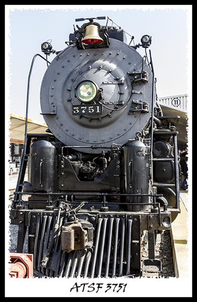
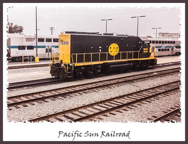
Since it was a Sunday when the Trolley schedule is abbreviated in the early morning, I made sure to get to the Trolley Station about an hour earlier than normal to make sure I caught a train and got to Grantville on time. Unfortunately, even thought I caught an 8:09 train, I only made it to the Alvarado Station before the conductor kicked everyone off the train. Seems that the brakes were not working properly. I had to wait another 30 minutes for the next Sunday morning train to come along. Here’s a picture of the brakeless train as it slowly limped out of the Alvarado Station, its three cars void of life as we know it:

San Diego Trolley at Grantville Station

Pictures copyright 2012 Russel Ray Photos

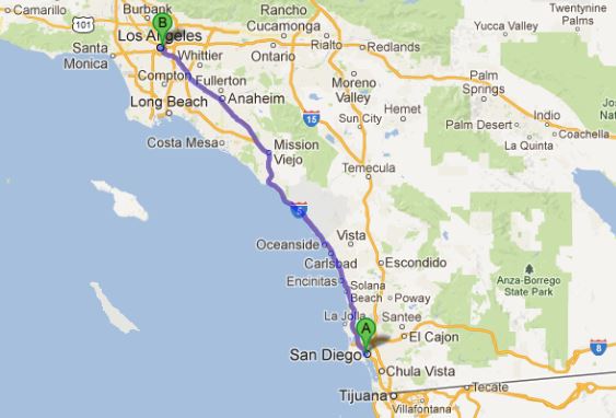
We arranged carpools at the Grantville Station parking lot, left at about 9:15, and got to Lake Morena County Park around 10:15. Our goal was to get to the Lake Morena dam and some rumored caves. While we were checking in with the park ranger and paying our $3 parking fee, the ranger informed us not to go past the NO TRESSPASSING sign to get to the caves. Apparently some spelunkers had forewarned the park authorities that a group of non-spelunking hikers were planning to go to the caves. Drat. Don’t spelunkers have anything else to do other than rat us out and keep us from having fun?

The County Park misled me into believing that the hike would be easy with nice, wide, paved trails:

San Diego Urban Exploration Meetup group

Pictures copyright 2012 Russel Ray Photos

Ha! Eventually the paved trail gave way to a dirt trail that got smaller and smaller:

San Diego Urban Exploration Meetup group

Pictures copyright 2012 Russel Ray Photos

San Diego Urban Exploration Meetup group

Pictures copyright 2012 Russel Ray Photos

San Diego Urban Exploration Meetup group

Pictures copyright 2012 Russel Ray Photos

San Diego Urban Exploration Meetup group

Pictures copyright 2012 Russel Ray Photos

San Diego Urban Exploration Meetup group

Pictures copyright 2012 Russel Ray Photos

San Diego Urban Exploration Meetup group

Pictures copyright 2012 Russel Ray Photos

San Diego Urban Exploration Meetup group

Pictures copyright 2012 Russel Ray Photos

San Diego Urban Exploration Meetup group

Pictures copyright 2012 Russel Ray Photos

Did you see the trail in that last picture? Neither did I, and I was there! Fortunately, about 90% of the time I was able to keep at least one person in sight in front of me; I was always dead last. I did get lost twice but eventually found my way back to the trail. Here is that last picture with a couple of red arrows pointing at two people on the trail. Everyone else was far far far ahead of me.

San Diego Urban Exploration Meetup group

Pictures copyright 2012 Russel Ray Photos

I see you, I see you. I’m coming, I’m coming.

San Diego Urban Exploration Meetup group

Pictures copyright 2012 Russel Ray Photos

At the top of the mountain peaks, the views were spectacular, especially the boulders:

Lake Morena County Park in Cleveland National Forest

Pictures copyright 2012 Russel Ray Photos

Lake Morena County Park in Cleveland National Forest

Pictures copyright 2012 Russel Ray Photos

Lake Morena County Park in Cleveland National Forest

Pictures copyright 2012 Russel Ray Photos

Lake Morena County Park in Cleveland National Forest

Pictures copyright 2012 Russel Ray Photos

Lake Morena County Park in Cleveland National Forest

Pictures copyright 2012 Russel Ray Photos

Near the top of one of the buttes was a vernal pool, which at least one dog was enjoying:

Lake Morena County Park in Cleveland National Forest

Pictures copyright 2012 Russel Ray Photos

And at the top was a big rock that I would have climbed on in my much younger days to look down at the valley a thousand feet below us:

Lake Morena County Park in Cleveland National Forest

Pictures copyright 2012 Russel Ray Photos

San Diego Urban Exploration Meetup group

Pictures copyright 2012 Russel Ray Photos

San Diego Urban Exploration Meetup group

Pictures copyright 2012 Russel Ray Photos

You can see a bronze plaque on the big rock that the three guys are sitting on. Looks like this:

Lake Morena County Park in Cleveland National Forest

Pictures copyright 2012 Russel Ray Photos

I tried to find out the story behind that plaque but there doesn’t seem to be any information in my books or on the Internet. Too bad. I think KMR and JDE should be known to all!

There is a plaque in Lake Morena County Park that does have a well-known story:

Lake Morena County Park in Cleveland National Forest

Pictures copyright 2012 Russel Ray Photos

That plaque commemorates the rainmaking exploits of pluviculturist Charles Hatfield (ca. 1875-1958). In 1915, San Diego was in the midst of a four-year drought. Hatfield was known throughout Southern California as a successful rainmaker with his secret mixture of 23 chemicals in evaporating tanks that, according to him, “attracted rain.”

The San Diego City Council approached Hatfield to produce rain to fill the Morena Dam reservoir. Hatfield offered to produce rain for free up to forty inches and then charge $1,000 per inch for forty to fifty inches and then free again for anything over fifty inches. In other words, $10,000 for fifty inches or more, payable when the reservoir was full. Hatfield and his brother, Paul, built a 20-foot evaporating tower beside Lake Morena for the chemical mixture.

On January 5, 1916, it began to rain heavily, growing more intense day by day. Dry riverbeds started flooding, and floodwaters destroyed bridges, phone cables, homes, and farms. Trains were marooned, and the Sweetwater Dam and Lower Otay Lake Dam overflowed. Although rain ceased on January 20, it resumed on January 22, and on January 27 the Lower Otay Dam broke, killing between 14 and 20 people depending on whose accounts you read.

Although Hatfield had fulfilled the requirements of his contract, the City Council refused to pay unless Hatfield accepted liability for damages; claims already were north of three million dollars, quite a sum in 1916. Hatfield tried to settle for $4,000 but wound up suing the Council. Two trials resulted in rulings that the rain was an act of God. Hatfield continued at least one lawsuit until 1938 when two courts ruled that the rain was an act of God, absolving him of any wrongdoing but also meaning that he would not collect any money for making it rain.

Charles Hatfield has entered American folklore in many ways:

  1. Gerry Jenkins wrote about the incident in his book
    Wizard of Sun City.
  2. The 1916 flood at Lake Morena is the subject of Widespread Panic’s song “Hatfield.”
  3. Burt Lancaster starred in the 1956 film “The Rainmaker,” inspired by the true story of Hatfield.
  4. Hatfield’s “moisture acceleration” was central to the plot of
    T. Jefferson Parker’s 2007 book “Storm Runners.”
  5. Joshua Davis, lead singer of Steppin’ In It, wrote a song about “The Weatherman” called “Charles Hatfield Blues.”

Pictures copyright 2012 Russel Ray Photos

You might have noticed that Lake Morena County Park is out in Cleveland National Forest. You might also be wondering where the trees are if it’s a National Forest. Well, 90% of the trees look like this:

Manzanita

Pictures copyright 2012 Russel Ray Photos

That’s a Manzanita, prevalent throughout the Southern California boondocks. It has beautiful red bark and lovely purple flowers.

Manzanita flowers

Pictures copyright 2012 Russel Ray Photos

Unfortunately, Manzanita, which can get as tall as twenty feet, are quite flammable, so when next you hear about wildfires in Southern California, you’ll know what’s burning in the boondocks. Wildfires are something that those who live in the Southern California boondocks have to put up with:

Lake Morena County Park in Cleveland National Forest

Pictures copyright 2012 Russel Ray Photos

Lake Morena County Park in Cleveland National Forest

Pictures copyright 2012 Russel Ray Photos

The other ten percent of trees in the boondocks are Coast Live Oaks (also called California Live Oak) and pine trees. Occasionally you’ll find a huge pine tree, the Coulter Pine:

Coulter Pine in Cleveland National Forest

Pictures copyright 2012 Russel Ray Photos

The Coulter Pine can grow to eighty feet tall, but the defining characteristic of this tree is its huge pine cones which can get to 16 inches long and weigh up to ten pounds. Although it’s illegal to take stuff out of National Forests, whenever someone finds these pine cones, they tend to take one with them. I didn’t find any on the ground (I already have one that I bought at a store in Julian) but here’s one still on the tree:

Pine cone from Coulter Pine

Pictures copyright 2012 Russel Ray Photos

Although we did not get to the caves, we did get to a nice vista point above the dam:

Morena Reservoir dam in Cleveland National Forest

Pictures copyright 2012 Russel Ray Photos

Lastly, yours truly above the Morena Dam:

Russel Ray at Lake Morena County Park in Cleveland National Forest

Pictures copyright 2012 Russel Ray Photos

We were in the boondocks for five hours. There was so much to see that five hours was rushing it. Will have to go back……..

For previous pictures from this mountain hike, see I can see for miles and miles and Need ID help from my bird experts.

Pictures copyright 2012 Russel Ray Photos

I'm Zoey the Cool Cat, and I approve this post

Looking for real estate services in San Diego County?
I can highly recommend
James Frimmer, Realtor
Century 21 Award, DRE #01458572

If you’re looking for a home inspector,
I recommend Russel Ray — that’s me!Real Estate Solutions

Pictures copyright 2012 Russel Ray Photos

Tall ship in San Diego

How to get yourself good and tired… and sore

Out & About

Pictures copyright 2012 Russel Ray Photos

One of the great things about San Diego is that there are so many ways to get around:

San Diego Trolley

Pictures copyright 2012 Russel Ray Photos

Amtrak

Pictures copyright 2012 Russel Ray Photos

Cruise ship in San Diego

Pictures copyright 2012 Russel Ray Photos

Tall ship in San Diego

Pictures copyright 2012 Russel Ray Photos

The Californian

Pictures copyright 2012 Russel Ray Photos

Jet ski

Pictures copyright 2012 Russel Ray Photos

Those are just a few. Obviously there’s the ubiquitous car, motorcycle, and bus, too. So yesterday I traveled 11.1 miles and today another 15.1 miles, all on this:

Russel Ray's bike

Russel Ray’s bike

Pictures copyright 2012 Russel Ray Photos

Yesterday’s ride was west, to the beach, specifically the end of the San Diego jetty where the San Diego River meets the Pacific Ocean and where a colony of fine, furry, four-legged felines live:

Feral cat at the San Diego jetty

Pictures copyright 2012 Russel Ray Photos

Today’s ride was east, into the boondocks, where the wildlife is a little more wild:

Bird in the wild

Pictures copyright 2012 Russel Ray Photos

Of course I have billions and billions and billions of pictures, but you’ll just have to wait because I am sore, sore, sore, needing a good soaking in the hot tub with a margarita close at hand.

And then, get this, the glutton for punishment that I am, I’m going on an 8-mile hike out in the boondocks tomorrow with the San Diego Urban Explorers, urbanites who explore the boondocks, not people who explore urbanity like you might think. Our goal tomorrow is to get to Lake Morena where, rumor has it (and in this case I discovered that the rumor is true), there are caves. Yahooo! Who knew there were caves in the San Diego County boondocks?!!

Morena Reservoir

View Larger Map

Pictures copyright 2012 Russel Ray Photos

I'm Zoey the Cool Cat, and I approve this post

Looking for real estate services in San Diego County?
I can highly recommend
James Frimmer, Realtor
Century 21 Award, DRE #01458572

If you’re looking for a home inspector,
I recommend Russel Ray — that’s me!Real Estate Solutions

Pictures copyright 2012 Russel Ray Photos

Santa Fe 3751 at Los Angeles Union Station

Roll up, roll up for the magical mystery tour

Out & About

Pictures copyright 2012 Russel Ray Photos

Roll up, roll up for the magical mystery tour. Step right this way….

Alright, maybe not the magical mystery tour, but a tour nonetheless. This one by train from the historic Santa Fe Depot in downtown San Diego to the historic Union Station in downtown Los Angeles.

San Diego to Los Angeles map

View Larger Map

Arrive at Santa Fe Depot on the San Diego Trolley:

San Diego Trolley at Santa Fe Depot

Pictures copyright 2012 Russel Ray Photos

Santa Fe Depot in San Diego

Pictures copyright 2012 Russel Ray Photos

Santa Fe Depot in San Diego

Pictures copyright 2012 Russel Ray Photos

Santa Fe Depot in San Diego

Pictures copyright 2012 Russel Ray Photos

Santa Fe Depot in San Diego

Pictures copyright 2012 Russel Ray Photos

The San Diego Trolley is in its 32nd year of operation. It is the fifth most-ridden light rail system in the United States. It’s a lot of fun to ride — clean, efficient, and on time.

The historic Santa Fe Depot opened on March 8, 1915. Originally it handled passenger traffic from three railroads, the Atchison Topeka & Santa Fe, the San Diego & Arizona Railway, and the San Diego Electric Railway. Currently it handles passenger traffic for Amtrak, the San Diego Trolley, and the Coaster. BNSF Railroad freight traffic passes through without stopping on an adjacent track, but only during the night; there is no freight traffic through downtown San Diego during daylight hours.

My Amtrak Pacific Surfliner train to Los Angeles, and the car I chose to ride in:

Amtrak Pacific Surfliner in San Diego

Pictures copyright 2012 Russel Ray Photos

Amtrak Pacific Surfliner

Pictures copyright 2012 Russel Ray Photos

If you ever need to find me on a train, I’m either in the very first car or the very last car. If the engine is pulling the train, I’ll be in the last car. If the engine is pushing the train, I’ll be in the first car. The views are better!

Once you get out of San Diego, keep your eyes open because there is a lot to see between San Diego and Los Angeles. Regardless of which side of the car you sit on, keep your head moving constantly from one side to the other because both sides have interesting things to see.

Pictures copyright 2012 Russel Ray Photos

Beach volleyball in San Diego

Pictures copyright 2012 Russel Ray Photos

We in San Diego are proud of the United States military located in the County. According to the San Diego Convention & Visitors Bureau, San Diego County now has the world’s highest concentration of United States military personnel, surpassing the D.C./Arlington, Virginia area a couple of years ago.

Between San Diego and the Los Angeles metroplex is Marine Corps Base Camp Pendleton, a huge military base comprising over 125,000 acres. Camp Pendleton is what prevents Los Angeles from annexing San Diego, but if we ever see peace in the world and Camp Pendleton is closed and developed, you’ll see a Los Angeles/San Diego metropolitan statistical area.

Camp Pendleton map

View Larger Map

Camp Pendleton Marines

Pictures copyright 2012 Russel Ray Photos

United States Navy on Camp Pendleton

Pictures copyright 2012 Russel Ray Photos

The San Onofre Nuclear Power Plant is at the northern border of Camp Pendleton, almost exactly sixty miles from my home. The first reactor was commissioned in 1968 and decommissioned in 1992. The second reactor was commissioned in 1983 and the third in 1984. It has been offline for a year due to various problems, and the longer it is offline, the more questionable it becomes as to whether it will be restarted.

San Onofre Nuclear Power Plant

Pictures copyright 2012 Russel Ray Photos

You’ll go right by the home of the 2002 World Series champions, the Anaheim Angels, known as the California Angels from 1965-1996 and known since 2005 as the Los Angeles Angels of Anaheim:

Angels Stadium of Anahein

Pictures copyright 2012 Russel Ray Photos

Angel Stadium of Anahein

Pictures copyright 2012 Russel Ray Photos

Of course, there is lots of train action in and between the nation’s second-largest and eighth-largest cities:

Pacific Sun Railroad

Pictures copyright 2012 Russel Ray Photos

BNSF Railroad

Pictures copyright 2012 Russel Ray Photos

BNSF Railroad

Pictures copyright 2012 Russel Ray Photos

BNSF Railroad

Pictures copyright 2012 Russel Ray Photos

BNSF Railroad

Pictures copyright 2012 Russel Ray Photos

Railroad turntable

Pictures copyright 2012 Russel Ray Photos

Metrolink

Pictures copyright 2012 Russel Ray Photos

Metrolink

Pictures copyright 2012 Russel Ray Photos

Metrolink

Pictures copyright 2012 Russel Ray Photos

Metrolink

Pictures copyright 2012 Russel Ray Photos

Amtrak

Pictures copyright 2012 Russel Ray Photos

Metro Rail of Los Angeles

Pictures copyright 2012 Russel Ray Photos

As you get close to Los Angeles Union Station, keep an eye out on the left side of the train. If you’re lucky, you’ll see Santa Fe #3751, a historic 4-8-4 steam locomotive built in 1927 by Baldwin Locomotive Works. It still runs on regular excursions throughout the United States. Sometimes you can even catch it at the Los Angeles Union Station, as I did.

Santa Fe 3751 at Los Angeles Union Station

Pictures copyright 2012 Russel Ray Photos

Also keep an eye out for views of downtown Los Angeles:

Downtown Los Angeles

Pictures copyright 2012 Russel Ray Photos

The tallest building in that picture is the U.S. Bank Tower. At 73 stories and 1,018 feet tall, it is the tallest building west of the Mississippi River and the tenth tallest in the United States.

Soon after you see the downtown skyline, you’ll arrive at Los Angeles Union Station, also known as the “Last of the Great Railway Stations.” It opened in May 1939, just as diesel engines were taking over from steam locomotives, and passenger traffic was starting a long decline that would finally end in 1971 with the creation of Amtrak.

Los Angeles Union Station

Pictures copyright 2012 Russel Ray Photos

Los Angeles Union Station

Pictures copyright 2012 Russel Ray Photos

Los Angeles Union Station

Pictures copyright 2012 Russel Ray Photos

Los Angeles Union Station

Pictures copyright 2012 Russel Ray Photos

To get from Los Angeles to San Diego, simply scroll up through this post!

Pictures copyright 2012 Russel Ray Photos

I'm Zoey the Cool Cat, and I approve this post

Looking for real estate services in San Diego County?
I can highly recommend
James Frimmer, Realtor
Century 21 Award, DRE #01458572

If you’re looking for a home inspector,
I recommend Russel Ray — that’s me!Real Estate Solutions

Pictures copyright 2012 Russel Ray Photos